
FREE SNAPSHOT REPORT FOR PE30 5LA
Unlock the secrets of your local postcode area
Want a quick overview of a particular neighbourhood, rather than paying for a full report? Our Neighbourhood Snapshot is an ideal way to quickly check the main statistics for any English or Welsh postcode, and it won't cost you a penny. To get your report for PE30 5LA, just click the button below.
Climate
Climate

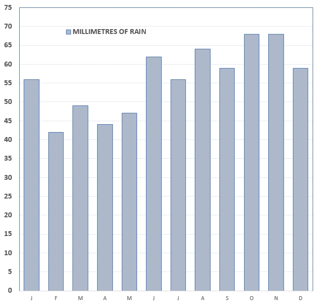
This region, like the rest of the British Isles, has a temperate maritime climate. It does not suffer extreme temperatures, and benefits from rainfall fairly evenly spread throughout the year. Coltishall, about 18 kilometres (11 mi) to the northeast, was the nearest official met-office weather station for which records are available.
East Anglia, jutting out into the North Sea can produce weather conditions that have less effect on other parts of the country, such as snow or sleet showers during the winter months on a northerly or easterly wind, or sea fog/haar during the summer.
The highest temperature recorded at Coltishall was 33.1°C (91.6°F) during June 1976. However, go back further to 1932, and Norwich's absolute record high stands at 35.6°C (96.1°F). Typically the warmest day of the year should reach 28.8°C (83.8°F).
Days of Sunshine

Rainfall (mm)
Get an unrivalled picture about this neighbourhood.
Our 55-page essential homebuyer's report provides you with an unparalleled source of information about any neighbourhood in England and Wales, including:
| CRIME RATES DEMOGRAPHICS HOUSE PRICES AFFORDABILITY LEISURE & AMENITIES | LOCAL IMMIGRATION SCHOOLS & UNIVERSITIES ENVIRONMENTAL ISSUES TRANSPORT INFO HEALTH ... and more |